
Each mission and each customer are unique. The SCIFLI team develops every mission based on a combination of the level of support requested by the customer and requirements determined by the team to be essential for mitigating risk. Below is a description of the many varied tasks and methods implemented over the life of this project.
Thorough planning is a key element to ensure the highest probability of success in conducting an imaging mission. The SCIFLI team typically engages flight operations and research personnel several months prior to a mission. There are numerous considerations that have to be addressed before each mission. The goal is to place the appropriate optical imaging asset in an optimal position to acquire the desired imagery at a given flight condition. However, there are always trade-offs and limitations imposed by physics, budget, weather, logistics and sometimes even international politics. To obtain a grasp of the proposed mission and the constraints that will be imposed upon the mission, the team begins with a detailed simulation in an interactive three-dimensional virtual environment.
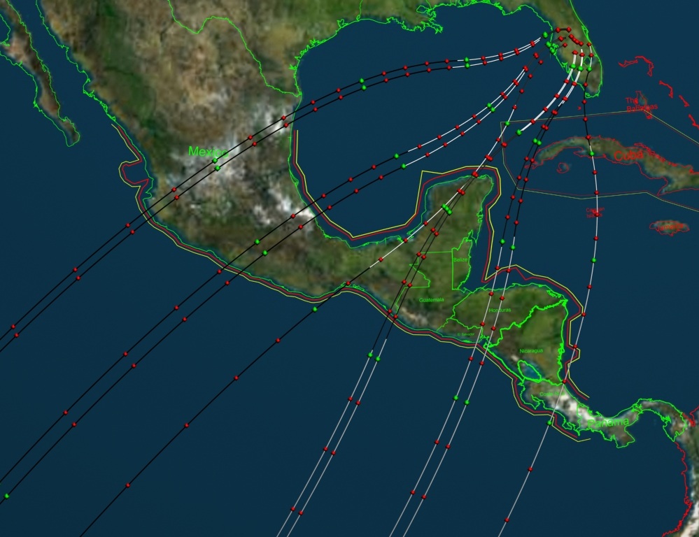
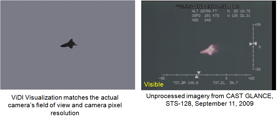
The first step of the process is to generate a mission simulation in our unique mission planning software and the invaluable Google Earth for reference. This set of software applications (based on the NASA Langley-developed Virtual Diagnostics Interface, or ViDI) utilizes a three-dimensional virtual environment within which a complete mission may be simulated. The virtual environment may consist either of a section of the Earth for missions that occur in a limited region (such as the MLAS test flight or our Sandia Solar Tower calibration test flights), or the entire planet, for simulating orbital space missions. First the vehicle trajectory is imported into the virtual environment. Then a scaled three-dimensional model of the flight vehicle is placed along the trajectory path to create a fully time dependent 6 degree-of-freedom visualization. Now, virtual cameras are added to the scene. The virtual cameras mimic the specifications of the planned optical systems and sensors such that simulated imagery is spatially accurate down to the pixel level. Now the mission planners can explore a wide variety of camera locations and/or camera and optical hardware configurations to determine both the optimal placement and the trade-offs of one type of hardware system opposed to another system.
Doing this within an accurate depiction of the geographical surroundings allows the incorporation of political boundaries, flight paths and airspace restrictions for airborne observations , potential basing options for land based systems and positioning for sea based assets. The virtual environment also allows the user to depict additional data such as the range of telemetry reception stations, the position of the sun at the time of the mission, and other considerations. Should the missions include extensive flight operations the team is equipped with commercial international flight planning software and team members with extensive piloting backgrounds.

As the mission planning evolves, the SCIFLI team is capable of taking on the required challenges to ensure success. This may include working with the US State Department to obtain over flight clearances from foreign countries, interfacing with the FAA to ensure immediate flight plan clearances for time critical aircraft movements, coordination with Department of Defense personnel for logistics and aircraft staging during missions, obtaining detailed weather predictions and historical trends, and continually following the state of the vehicle flight readiness.