Here, you can learn how the SCIFLI team develops and executes imaging missions.
Mission Development
Once a mission is identified as a possible SCIFLI project, the first step is to produce a simulation of the mission in an interactive three-dimensional virtual environment. Depending on the size of the mission (short atmospheric flight, suborbital or orbital) the virtual environment will include a local section of terrain or shoreline / ocean, or sometimes the entire globe. Once a virtual environment is in place, the vehicle trajectory is imported into it, typically in 1 second intervals. The trajectory data is usually provided as latitude, longitude and altitude, but other formats are sometimes used.

The next step is the inclusion of a three-dimensional computer model of the flight test vehicle. This can come from a CAD (Computer Aided Design) model or a Computational Fluid Dynamics mesh. Computational Fluid Dynamics, or CFD, is the use of numerical analysis and data structures to analyze the flow of a fluid (in this case, air) around an object. We can also prepare a lower fidelity (less accurate) model from drawings and dimensions provided by the customer. The vehicle model is scaled accordingly, and set to follow the trajectory path with each trajectory time step typically representing a frame of an animated computer file. Now when the user specifies a particular moment in time the vehicle will be at the correct location in space. Should a full 6 degrees-of freedom trajectory file be available the roll, pitch and yaw of the vehicle can be included. A 6 degree-of-freedom model is one that allows the user to view the vehicles rotation in 6 different directions.

Virtual cameras are placed in the scene, each with the ability to mimic the field of view and spatial resolution of a real camera / telescope system. The mission can be planned out now in the virtual environment, with numerous what-if scenarios played out realistically in the three-dimensional computer world. The simulated camera views provide high fidelity approximations of what the actual camera views would show.
Mission Planning
Once the go-ahead is given to conduct a mission, the SCI-FLI team works with the customer and the asset operator(s) to put all of the elements required to conduct the mission together. This varies significantly based upon the imaging asset, requirements of the customer, and the location of the deployment. At times the SCI-FLI / HYTHIRM team has obtained diplomatic clearances for aircraft to conduct operations in foreign airspace, organize with local authorities for the placement of ground based imaging systems, work with meteorological experts to understand long and short term weather forecasts for basing, deployment, launch and or recovery areas. And the SCI-FLI / HYTHIRM team ensures that the required optical equipment and logistics for it transport is conducted in a proper and timely manner.
Another aspect of the mission planning is the team’s use of mission simulations, or sims, to practice and train. It is typical for the mission operations personnel to work with the flight team by participating in existing sims planned out for the vehicle mission controllers. SCI-FLI often “piggybacks” on these sims to gain a high degree of situational awareness of the nominal and off nominal (normal and abnormal) events that could affect the ability to conduct the desired imaging.
As the actual mission approaches, the SCI-FLI team ensures that hardware, software and personnel are all properly prepared for the upcoming mission.
Radiometric Simulations
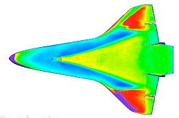
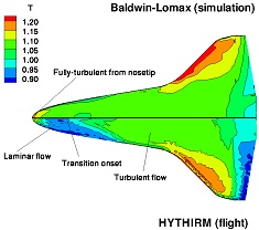
The SCi-FLI / HYTHIRM team has made extensive use of radiometric modeling in order to understand the behavior of thermal imaging sensors under expected conditions. This modeling effort begins with a provided heat distribution pattern on the vehicle (usually from computational predictions) and ultimately determines the response of each pixel on the imaging array. This modeling takes into consideration the bit depth of the camera, gain, integration time, filters, atmospheric losses, image or solar glints and the behavior of the electronics in the system. This provides a very useful reference for the asset operator, as it guides the initial camera settings and shows the operator what the desired imagery should look like.

Calibration
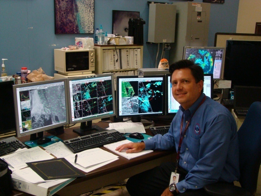
The imaging sensors undergo a careful calibration for thermal and spectral response as well as spatial deformation. A detailed calibration is conducted, and just prior to the mission a “spot check” is conducted to ensure that there have not been any major changes to the system. The SCI-FLI group can provided expertise and equipment for calibration as deemed necessary on a mission to mission basis.
Mission Operations
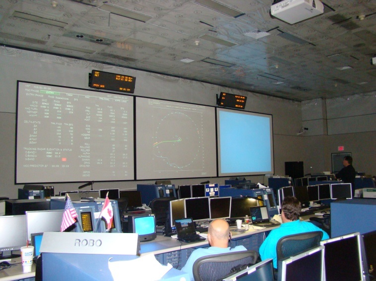
As the mission day approaches, the SCI-FLI mission coordination team will generally deploy to a location where there is clear and open communications with the flight mission control team. For the Space Shuttle missions, this was the Mission Control Center (MCC) at the NASA Johnson Space Center on Houston. The SCI-FLI team follows the progress of the mission and relays any required changes to the asset operators. The SCI-FLI principle Investigator is responsible for providing a team with a goal based on the scientific rational for obtaining a particular measurement, while the Project Manager provides the real time authority to proceed with the operations or any changes to procedures based on unfolding events. An extreme example of this occurred twice during the HYTHIRM Shuttle missions when weather forced a diversion from landing the Shuttle in Florida to landing in California. The mission operations team carefully analyzed the situation, ran simulation in the virtual environments to understand the changes to the mission, and was in close collaboration with the Spaceflight Meteorology Group (SMG) at MCC and re-planned the mission to move our observation aircraft from the Gulf of Mexico, where it was stationed, out to the Pacific Ocean. On both occasions the mission was successful. Additionally, the HYTHIRM Airborne Asset Coordinator (a former test pilot) was in contact with the FAA (Federal Aviation Administration) and foreign airspace representatives as he worked out differing solutions on flight planning software to provide realistic options and recommendations to the aircrews. It should be noted that the ultimate responsibility for safe and proper operation of the imaging assets lies with the crews of the assets themselves. The role of the SCI-FLI mission coordination team is to provide realistic and timely updates and recommendations to support the field assets so they may obtain the highest quality, highest value data possible.
Post Mission
The SCI-FLI team is responsible for collecting and archiving all of the mission data, and turning the data over to the customer. Based on the mission and the customer requirements the SCI-FLI team may be responsible for having the data processed by the asset operator or a third party. Since the SCI-FLI team has extensive aerothermodynamic background the team can facilitate data comparison with computational fluid dynamics or wind tunnel data if desired.